Pleasanton-Hamilton 100, CA

This ride actually starts at the Pleasanton BART, and traces over much of Miles 50-140 of the grueling Devil Mountain Double, held each April. You get all flat miles for the first 12 or so miles, and then it’s a lot of climbing until Mile 60! Fortunately, nothing is super steep!
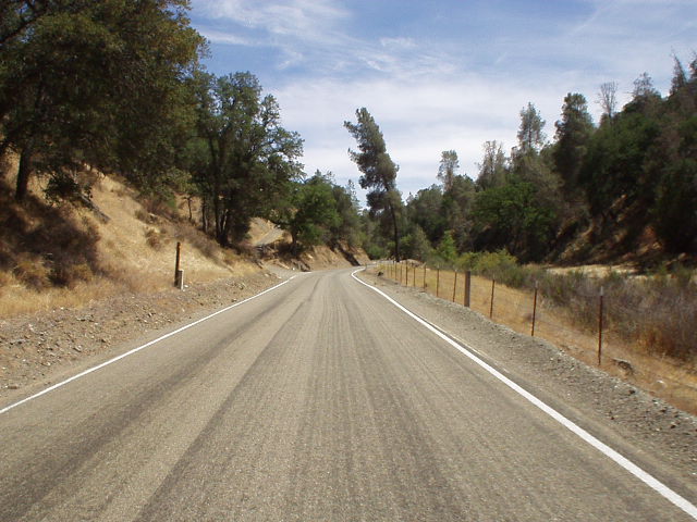
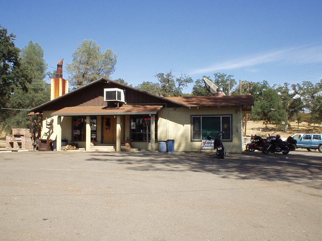
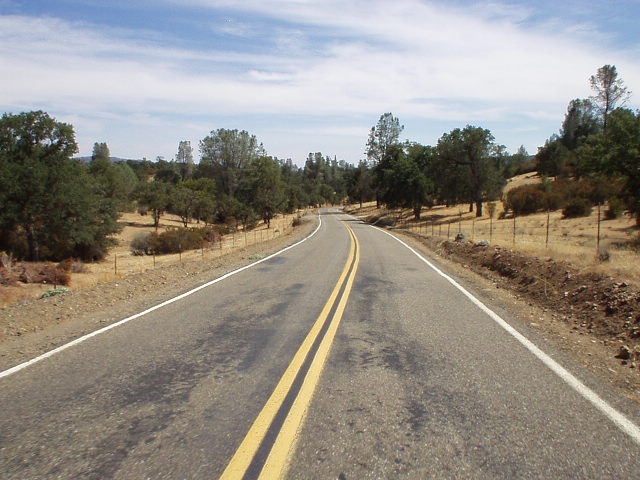
The main features of this ride are Mines Rd. and San Antonio Rd. The latter goes up the backside of Mt. Hamilton. Mines is a gradual climb that is one of the most remote areas in the Bay Area. You will see no homes, buildings, or traces of civilization except for the occasional motorcycle rider. Thankfully, before the climb up the backside of Mt. Hamilton is a single bar/cafe called “The Junction”, where you can get some water (either buy the cold bottled ones), and have a delicious (and reasonably priced) sandwich or burger. Do both because you will likely need the water and energy to get up Mt. Ham!
At the top of the mountain is the famous Lick Observatory, where you can fill up your water bottles again and stop at a real bathroom. Enjoy the views, and from there, look forward to a long descent down the switchbacks of the front side of Mt. Ham, interrupted by 2 short and gradual climbs. After that, it’s all flatlands back to Fremont!
Due to the remote nature of the roads there are few opportunities to bail or even get help if you have a problem. Be prepared and have fun!
Route Sheet
| Total | Segment | Directions |
| 0 | Pleasanton BART station | |
| 0 | East on Owens Dr. | |
| R on Las Positas Dr. | ||
| R on West Las Positas Dr. | ||
| R on Santa Rita | ||
| L (east) on Valley Ave. | ||
| L (east) on Stanley Ave. | ||
| R on Livermore Ave. | ||
| 2 | After downtown Livermore, bear left on Tesla Rd. | |
| 13 | 30 | R (south) on Mines Rd. |
| 43 | 0 | Stop at The Junction Cafe for lunch! |
| 43 | 1 | Straight (south) on San Antonio Rd. |
| 60 | 0 | Made it to the top! Fill up water bottles inside Lick Observatory. |
| 60 | 18 | West on Mt. Hamilton Rd. (Hwy 130); descend frontside of mountain, down switchbacks |
| 78 | L (west) on Alum Rock Rd. | |
| R (north-west) on McKee | ||
| R (north) on Toyon | ||
| L (west) on Penitencia Creek Rd. | ||
| 4 | R (north) on Piedmont | |
| 83 | At Calaveras Rd. intersection, keep on going straight. Becomes Evans Rd.; then Jacklin. | |
| 2? | R on Warm Springs Rd. | |
| 4? | Warm Springs becomes Osgood Rd. | |
| ~3 | L (north) on Fremont Blvd. | |
| ~1.5 | R on Walnut | |
| 96 | 0 | Finish at the Fremont BART station. Done! |
From the Logbook
August 17, 2002 (Sat)
I got a late start as I got to the Pleasanton BART station at around 11:50 or so. Starting from there, and not really following anything but my sense of directions, I got lost around Pleasanton a little bit which added on a mile or 2, but found roads of familiar names like Valley and Stanley. From there, I got to Livermore and Mines Rd. without a hitch. The weather was nice; a little warm, but not sweat-on-the-top-tube hot.
There were remnances on the road from the Devil Mountain Double, including some spray-painted words that said, “Last ‘real’ hill before lunch [at The Junction]”. I appreciated seeing them, and they also brought back memories.
I ran out of water before hitting The Junction Cafe, and was forced to stop there to get more water and grab a bite to eat. I bought some bottled water, though after I bought a delicious turkey sandwich, the hostess asked if I’d like to have my water bottles filled, so evidently she didn’t mind. Going up the backside of Mt. Hamilton, I stayed within myself, going a leisurely 5 mph… the backside is steeper than the front, but because Mines Rd. had some climbing already, the backside is much shorter than the front and, to me, more pleasurable. And it’s still not ridiculously steep.
I got to the top by 5:40 p.m. or so and chatted with some employees outside who were just beginning to have dinner. Apparently, they host some concerts in the Lick Observatory (choir groups, etc.) every other weekend or so! They mentioned that I was very lucky to be going up on this particular day in which it was at least 10 degrees cooler than yesterday; indeed, there was a nice breeze.
From there I descended down the numerous switchbacks, and nothing was really difficult during the ride, though there was a headwind most of the way back to Fremont, and I could only think about food and what I wanted to eat at home. I was glad I brought my blinking taillight, as I’d beat sunset, but only barely. Back home at 8:00 p.m.; dinner time!