Monument Valley and the Road Less Traveled

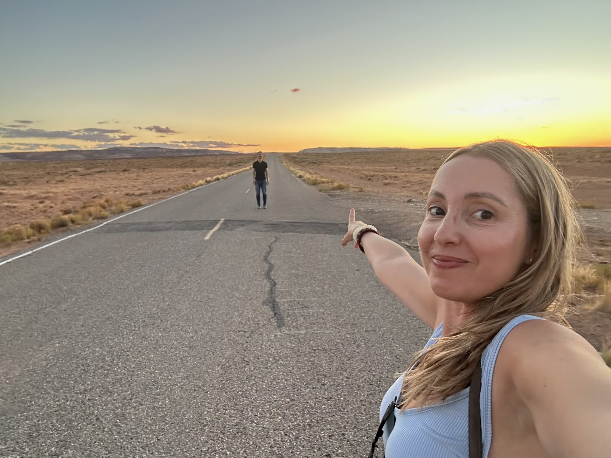
Continuing from the last post, we had a minor disappointment after a great driving tour of the San Juan Scenic Byway: we almost made it to the Four Corners Monument, but before the last minutes, the gate was closed by the employee as we arrived. The opportunity of standing in four states simultaneously slipped away. But we didn’t let it dampen the trip—in fact, the mood shifted quickly when Andrea insisted, “Can you pull over?”
We were driving along a long, deserted pavement stretch. The road went on for miles and miles and miles toward a broadening sunset; we literally didn’t see any other cars for miles. We turned off the main highway onto a dirt side road. I parked the car and we stepped out into the fading light, alone in the middle of nowhere.
We got some lovely shots: Andrea and I wandering into the road, framed by that stretching horizon and the glowing sky. We even did some silly jump-shots in the middle of the road, baboon-style—I haven’t posted those, but they’ll make us laugh in private later. However, I do think this one that Andrea took is definitely a keeper.
Overnight in Bluff, Utah
After the sunset stop, we headed on to the tiny town of Bluff, Utah for our lodging that night. Bluff is a very small community in San Juan County, southeastern Utah. Its population was about 240 according to the 2020 census. The median age is very high (in one recent estimate, nearly 70 years) and the town is very low-density and quiet.
Bluff doesn’t have a lot of stores or restaurants—it has that remote, off-the-beaten-track feel. But we were lucky to find one restaurant still open: the Canyon Smokehouse. We enjoyed a nice Mexican-food dinner on its back porch, lit by a string of white Christmas lights, with red-umbrellas shading the tables, and the temperature near perfect for evening. It was charming, relaxing, and exactly what we needed after a packed day of driving and sight-seeing.
Our lodging was only a couple hundred metres away—at the Kokopelli Inn. The Kokopelli Inn is a simple and comfortable inn in Bluff that provides a solid base in this remote region; its location means we were able to rest without fuss and wake up ready for more exploring.
Heading for Monument Valley
The next morning we departed Bluff and drove toward Monument Valley, which Andrea had long wanted to visit (and I was excited to see for the first time). On the way we passed the iconic stretch of U.S. Route 163 near the state-line where the scene from the film Forrest Gump was shot—you know, the moment when Forrest decides to stop his cross-country run and just turns around. It’s now called Forrest Point or Forrest Point Hill, and almost everyone who passes through here for the first time will jump out of their cars and wander out into the road for photos. We did.

When we arrived at the Monument Valley Visitor Center I was caught off guard by the entry fee. The sign said $8, which didn’t seem bad—except it turned out to be $8 per person. Then I realised time was tight: after parking I checked GPS on how long we’d have before we needed to hit the road to our next stop, Antelope Canyon (our guided-tour reservation awaited). The day before I had asked Microsoft Copilot what time it was at Antelope Canyon, and I had deduced there was a one-hour time difference between Bluff Utah and Arizona. So I asked Bing “What time is it in Arizona?”—it said the same time as my phone (which was set for Utah time). That threw me off: if Arizona were the same time, that would mess up our schedule.
“Oh, shoot,” I said, “We really have to hit the road right now! Good thing we’ll be passing back through here tomorrow.”
We snapped a few photos and literally three minutes after parking, were back on the highway. A couple of hours later, we arrived at Antelope Canyon with about 12 minutes to spare for check-in.
When I checked in I said “I’m here to check in.” The female employee replied, “Great, but you’re one hour early.”
It turned out my original thinking was correct: Arizona is one of only two U.S. states that does not observe daylight savings time. And to complicate things, the Navajo Nation—which is in Arizona and does change their clocks—governs the land where Antelope Canyon is. I would only realize later that the tour would express all of its times in Phoenix time despite that. Got that? The whole clock situation there is utterly screwed up, but at least we did not miss the tour.
Good thing, because Antelope Canyon was just as spectacular as you may have seen on Instagram. Or on Microsoft Desktop wallpapers. It was well deserving of its own post.
Stay in Kayenta, Arizona
Later that evening, after visiting Page, Arizona and Antelope Canyon, we made our way back toward Monument Valley and stayed in Kayenta Arizona for the night. Kayenta is located about 25 miles south of Monument Valley and is part of the Navajo Nation. Its population is a tad over 5,000. It has a number of hotels and motels serving visitors to Monument Valley. One note: as with many places on the Navajo Nation, the service of alcohol is illegal.
The next morning I got up for a run. Running is one of the best ways to get an initial feel for a place. I was going to start through a residential area away from the highway. But only a quarter-mile in I changed my mind. Dogs. It seemed like everyone out here had a dog—not little toy poodles, but large working-type dogs you’d have if you lived out in the middle of nowhere and were concerned about safety. Mindful of having already been bit twice by dogs within the last two years, I stuck the sidewalk and a trail off the main road, even doing a few 100m sprints.
The views were quite nice. The climate too: high desert, big sky, rugged but calm.

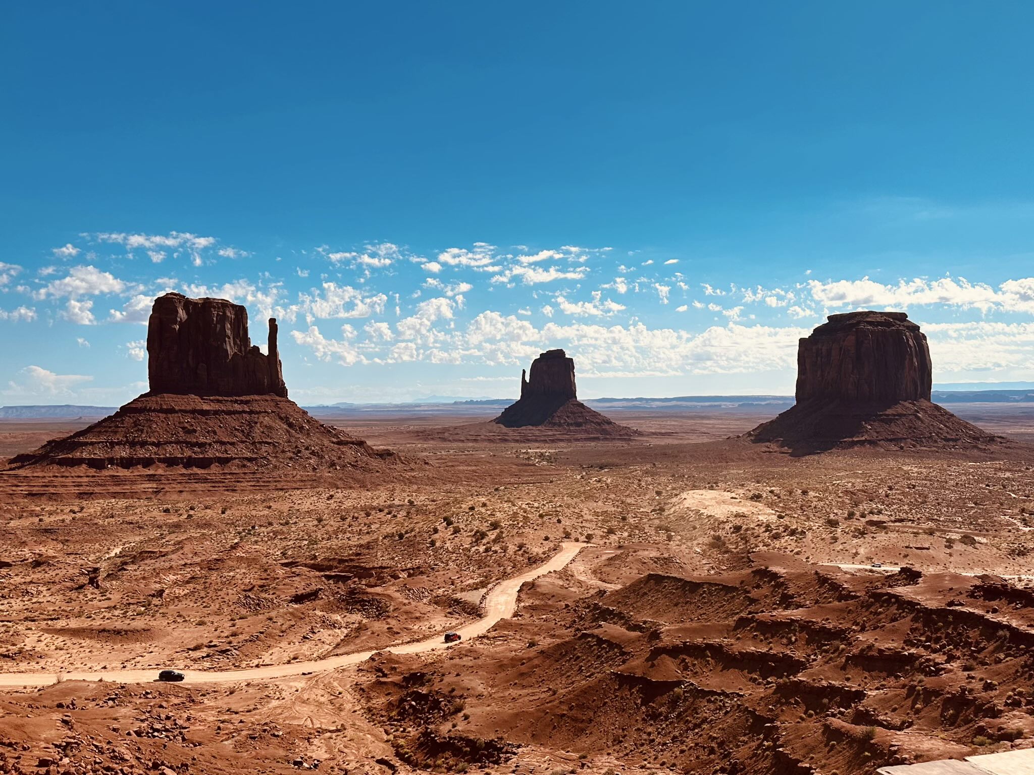
Back to Monument Valley—the real deal
Once breakfast was done we returned to Monument Valley (yes, paid $16 again for two people) and spent about an hour and a half hiking and taking photos. Seeing the formations up‐close was magnificent. We saw most of the main buttes: the West Mitten Butte, East Mitten Butte, Merrick Butte, Elephant Butte, Camel Butte and more.
On a future trip, I’d plan to spend several hours here hiking around—or even take the full 15-mile dirt/gravel scenic drive. Teeter, my Audi TT roadster, would not have had sufficient clearance—but most other vehicles would. We saw someone attempt it in a Ford Mustang convertible rental car.
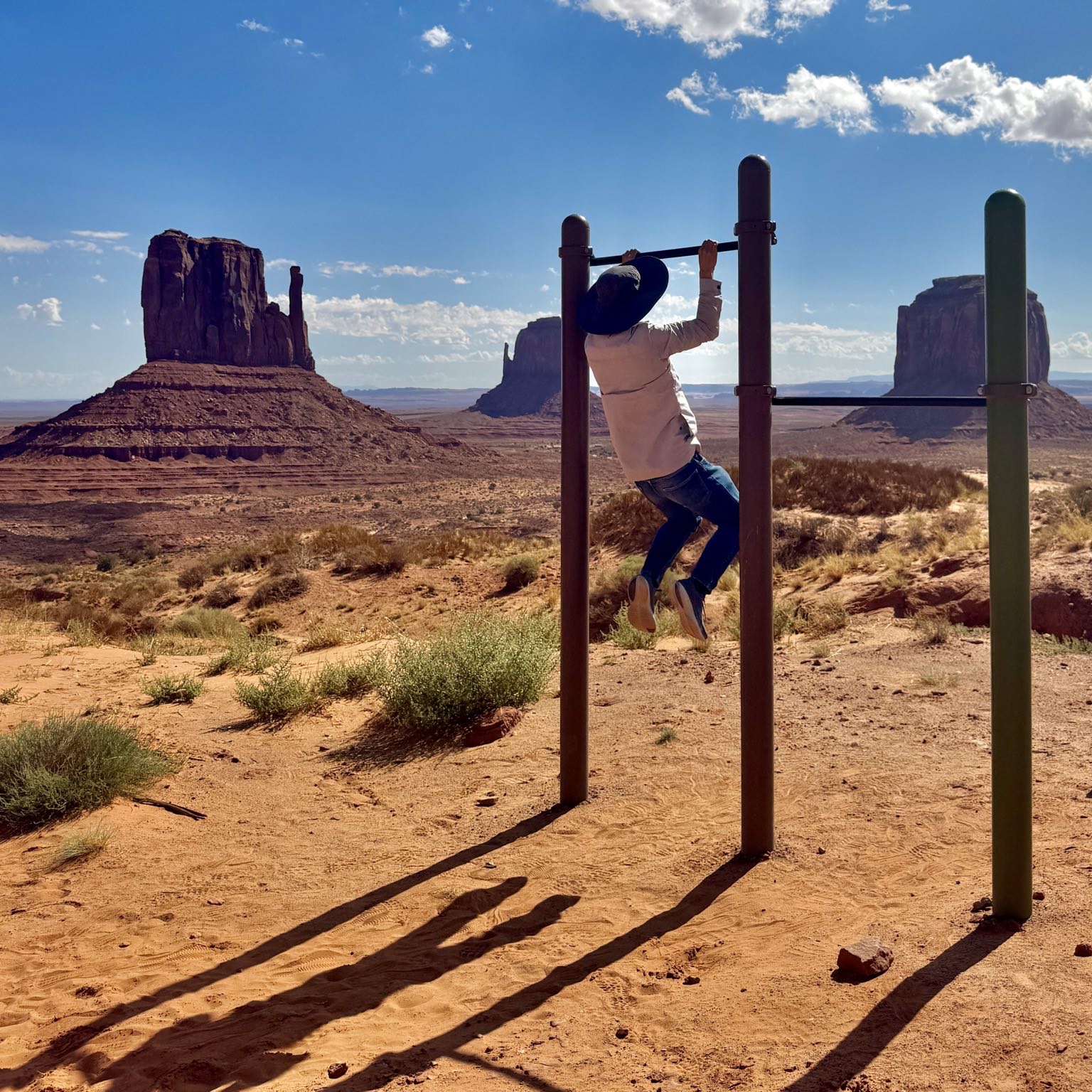
The land here belongs to the Navajo Nation and there are strict rules: no hiking off-trail, no biking or cycling in certain areas, no RVs on the loop, speed limit is 15 mph on the scenic road, drones are prohibited, and sunscreen is highly recommended (that Arizona/Utah sun is intense). When we were there the temperature was in the low 80s °F—comfortable—and because the elevation is around 5,000 feet the sun’s intensity is tempered a bit. It was actually cool enough that I was comfortable doing pull-ups here wearing a light jacket, jeans, and sunhat.
Geologically, Monument Valley is a classic story of erosion: what began as sediment deposited from rivers and uplifted formations on the Colorado Plateau has been slowly sculpted by wind and water over millions of years into the dramatic buttes and sandstone towers you see today.
It’s one thing to see photos; quite another to stand among the towers, the red rock dust on the road, the expansive sky overhead, the quiet of it all—and know you’re somewhere that the image of the American West was built around.
This trip reminded me that sometimes the unplanned moments (the empty road at sunset, the pull-over request, the quiet small town dinner) become as memorable as the big attractions. Yes, we missed Four Corners, but I’ll remember that desert roadside stop for a long time. And Monument Valley… well, it lived up to the hype. I’m glad we went, and I’m glad Andrea was there to make sure we slowed down, pulled over, and captured a moment together.


