Devil Mountain Double Century
I decided to ride the Devil Mountain Double after all. Never mind that I had not ridden the recumbent even one time since Solvang, or that it was going to rain. After sleeping for 2.5 hours I was driving down to San Ramon to the start of the ride (near the Blackhawk Auto Museum) and was on the recumbent by 5:00 a.m.
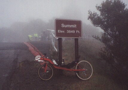
I made it to the top of Mt. Diablo (3900 ft) okay… just 10 minutes off my time from last year on Canny. It was really wet and foggy up there, which made the descent rather chilly, but otherwise I was feeling okay. However, just a couple of hours later, I missed a turn, and got off course by 14 miles. Whoops.
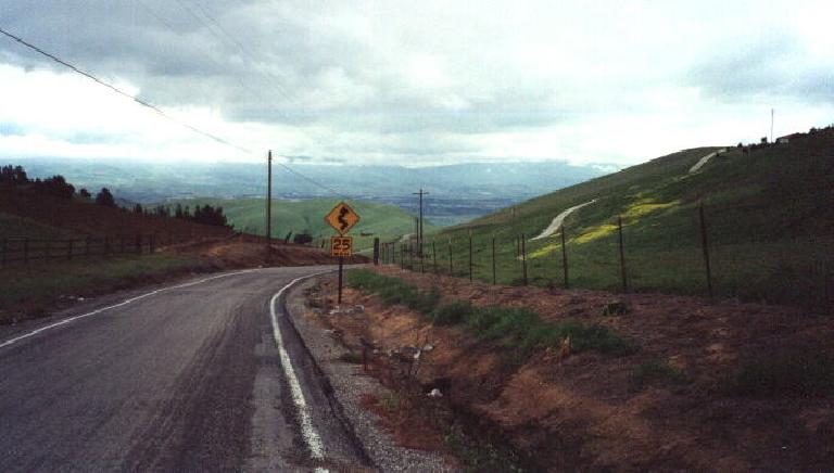
This of course, means I had to add another 14 miles (plus a ton of climbing through the rain) to get back ON course, and lost over 2 hours right there. My chances of getting to the next checkpoint before it closed, much less finishing the ride by midnight or so, were quickly slipping away. It didn’t help that the road I initially overshot was replete with slick sections that were so steep that my rear wheel would spin/slip when I’d really press hard on the pedals in my lowest gear, I was basically crawling up this pass. But I did make it to the checkpoint before everyone left.
During all of this time I was continually debating my options, which included finishing the ride and going for a personal long-distance record of 234 miles and possibly 23 hours of riding, but alas, on Altamont Pass Rd., I started falling asleep. I even fell asleep long enough that I went off the road and promptly crashed, but luckily I was going so slow here (since I was sleeping) that I didn’t get hurt. I then took a nap for 20 minutes (on the side of the road, not while riding anymore) and then concluded that making it to the next checkpoint on time was impossible, and that I’d be disqualified from the race anyhow. So I conceded defeat here and turned around and had a new goal of finding a way back to the start/finish of the ride, where Goldie was waiting for me.
That’s when the ride became really interesting. You see, I was approaching Tracy at this time, and knew exactly how to get back to San Ramon _by_car_ (just take I580 to I680), but was not familiar with any roads around there that could take me back by bike. And surely I was not going to go back the way I came from, which was not a direct way and would require climbing up Mt. Diablo again. So, I decided to take a gamble and just follow my sense of direction, looking for any Frontage Road or Ave. or Blvd that seemed to run adjacent to I-580.
This was totally working and after a couple of hours, I was over the Altamont Pass again and into Livermore. Just one more major mountain range and I’d be in Pleasanton/Dublin where I’d be home free—I could even take the BART if I had to—but at the west end of Livermore, I seemed to be at a dead end with no way to get over the mountain pass. Oh no.
Fortunately, I had a cell phone with me, so I called my friend Esther, asking if she had a map of Livermore. While her dad was running all over the house looking for one (but couldn’t find one), she used a street-mapping CD-ROM I gave her, looking for a route I could take to get me over this mountain. After 10 minutes, she was like, “Gosh… you know what, I really don’t see a way.”
I then briefly tried to hitchhike my way over this mountain (an attractive young lady in a new Lexus SUV passed by and ironically asked me for directions to get to Foothill Rd. in Pleasanton, and I was like “I’m actually trying to go there myself… just go west on I-580… hey, if you give me a ride I can even show you how to get there” and she just smiled and then said “no thanks” and rolled up her window and sped away in the wrong direction). Hence I decided that I would have to have the ride organizers’ support vehicle come and pick me up. So I tried calling their emergency cell-phone number, but alas, I kept getting a Sprint PCS message that said their phone was out of range. I then thought, “I know… the ride organizers are at the Marriott’s Hotel in San Ramon, so I’ll just call the hotel” and tried calling Esther again to do a Yahoo Yellow Page search for it, but her line was busy. So then I called Loren (who, unbelievably, was home) and he gave me a couple of numbers. He also then proceeded to do a MapQuest search on the internet to try to to help me out, but like Esther, could not find a way to get me back to San Ramon.
So I tried his phone numbers. The first number turned out to be some sort of sex line. I’m not making this up. But the second number worked. Unfortunately, the guy at the hotel was clueless that there even had been over a hundred riders who had taken off from his hotel earlier in the day, so he transferred me to a woman who wasn’t clueless and who in turn transferred me to the room of one of the ride organizers. Alas, the line was busy and I kept getting her voicemail. I started to leave a message only to be cut off a couple of times. Finally, after multiple calls, I was able to leave a complete message, but after 10 minutes of waiting, I didn’t get a call back. So I then tried calling the female receptionist at the hotel I had just talked to, but she left for the day.
I am giving all of the details only to show how comical my lack of luck that day was being…
Anyhow, it actually turned out to be good that this lady left for the day, as it forced me to talk with another receptionist, who was awesome. He actually was a cyclist himself and had a detailed map of the entire valley, so he was like, “Where exactly are you?” Then he told me precisely how to get back. I didn’t have any writing instruments at all, but thank goodness I only had to memorize 5 main roads or so. There was renewed hope that I could make it back under my own power and even before dawn.
And indeed, after another couple of hours of riding… I had made it back. Total mileage for the day was 140 miles, after 13.5 hours of riding. I didn’t get credit for ride of course, making it my second DNF (did not finish) this year, but what an adventure. And at least I would get a full night’s sleep that night.
Ride Data
- 137 mi.
- 5:00 a.m. start, 6:40 p.m. finish – 13:40
- Average Speed: 12.3 mph moving, 10 mph total average
- Max Speed: ~40 mph
- Total Climbing: Mt. Diablo, Morgan Territory road, Altamont Road, others
Rating
(5=best)
- Scenery: 4
- Support/Organization: 4- Route markings could have been better.
- Food: 3
- Weather: 2- Rainy
- Relative Difficulty: 5
- Overall Rating: 3 Really wish I didn’t get lost so I could have done more of the ride.
